Canadian Provinces
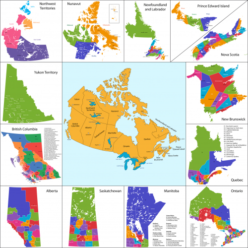
Can your child identify the ten provinces of Canada? If your little learner needs any help with the geography of Canada, then look no further than this free printable map!
This map of Canada’s ten provinces color codes each province in addition to labeling the inner portions of each province. Help your child reach important levels of understanding such as identifying, labeling, and creating using this free map.
For a real test of the highest level of understanding–creation–print out this map, and use little post-its to cover up the names of the provinces. Have your child label and re-create the map to demonstrate true understanding of the geography.
