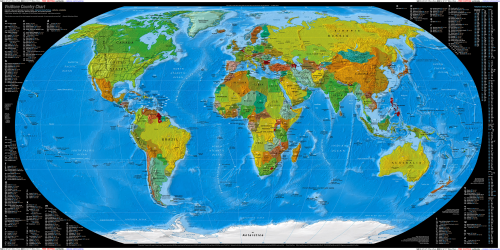
World Map
At first sight it seems to be just another world map. But it isn’t. It is a political and physical relief map showing countries and their borders, the contour of landforms, mountains, plains, oceans, seas, etc. The Robinson projection enables us to see the whole globe at once.
What makes this world map special is the data shown at the edges of the image, namely internet top-level country codes, telephone dialing prefixes, plus the latitude and longitude coordinates of the country. Enjoy studying our beautiful globe with this priceless world map!