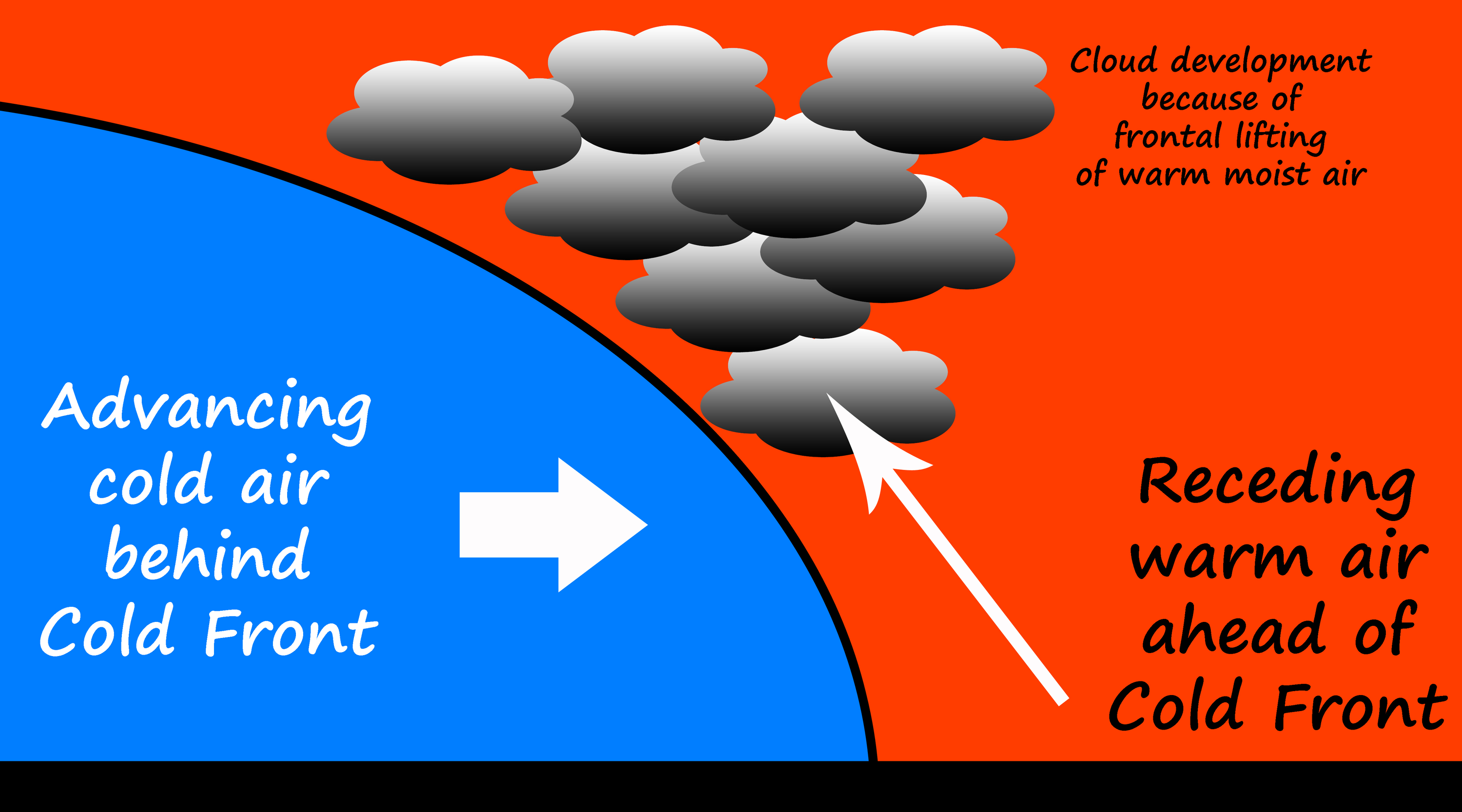
Cold Fronts
Large masses of cold air move quickly and can push into areas of warmer air. The edge where the cold air meets the warm air is called a cold front. Because cold air is denser than warm air, the cold air mass will push up, or wedge under, the warm air, helping to lift it up. This creates a lot of low pressure (as warm air moves up and away) along the cold front. If the warm air is moist, lots of clouds can form along the cold front. In cases where the cold front moves quickly and the warm air is much warmer than the cold air, severe storms with hail and even tornadoes can occur.
Here are some of the effects of a cold front:
Pressure: As a cold front moves past, the pressure drops, then slowly rises again once the cold air mass is in place.
Temperature: The temperature drops rapidly as the front moves past, then continues to drop slowly.
Clouds: Clouds form as the front passes, and increase in cover and height.
Precipitation: Rain or snow as front passes, possibly followed by heavy storms.
Visibility: As the front comes past, haze is common, which then clears after the front has passed.
On weather maps, cold fronts are usually drawn as blue lines, sometimes with triangles on the lines pointing in the direction that the cold front is moving. Warm fronts, on the other hand, are drawn in red with red half-circles showing their direction of movement. Where a cold front catches up to a warm front, an area called an occluded front, the line is drawn in purple with alternating triangles and half-circles.
Find out more about thunderstorms!